Dr. Susan Mary Berta passed away Wednesday May 22, 2024, at her residence in Terre Haute, Indiana. She was a professor at Indiana State University’s (ISU) Department of Earth and Environmental Systems, where she retired in 2021. She started her career at ISU in 1986, later serving as the department chairperson from 2002-2009. She was also the Interim Coordinator of the Science Education Program from 2005-2007. She published over 25 journal articles and reports, with specializations in physical geography, geomorphology, and remote sensing, in addition to supervising the research of and mentoring 13 graduate students.
Born July 29, 1957, in Flint, Michigan, she received a B.A. degree in Physical Geography from the University of Michigan-Flint and graduate degrees in Geography: M.S. from Oklahoma State University and Ph.D. from the University of Oklahoma. Her master’s degree research involved using remote sensing technology and GIS, as well as field verification, to identify prospective locations of “natural areas” throughout Oklahoma for “wilderness” status consideration. Ph.D. work involved using aerial and satellite data to map periglacial landscapes in the Sangre de Cristo Mountains of Colorado. As a graduate student, she assisted in three-week wilderness “research adventures” and later offered field camp at ISU for undergraduate and graduate students for 10 summers. Her favorite part of her professional career was always the research, field trips, and friendships accumulated throughout the years.
Berta’s heart belonged to the Terre Haute Humane Society, where she volunteered for over 30 years and served as a member of their Board of Directors. She also served as a Director on the Board at the Ouabache Land Conservancy, partaking as a member since 2013.
Don Zeigler’s colleague, Jonathan Leib, reports that Don knew at an early age that he wanted to be a geographer. While in high school he joined the American Association of Geographers (AAG) and was a member for the rest of his life. His career began with teaching high school geography for three years. After earning his Ph.D. in 1980 from Michigan State University, he became a professor in the Department of Political Science and Geography at Old Dominion University until he retired in 2016. He was department chair from 1990 to 1994.
In 1986, in cooperation with the Virginia Department of Education, Don wrote a proposal to create the Virginia Geographic Alliance (VGA). He worked to secure funding from Gilbert Grosvenor, Chairman of the National Geographic Society (NGS) and Gerald Baliles, Governor of Virginia. He helped lead the VGA for more than 30 years and the organization continues to serve students, K-12 educators, and higher education faculty across Virginia.
Don was president of the National Council for Geographic Education (NCGE) in 1997. He was president of Gamma Theta Upsilon, the international geography student honor society in 2009 and 2010. During the 1990s he worked to create the Advanced Placement Human Geography (APHG) program. In addition to a term as Chief Reader, he led annual readings and conducted workshops, institutes, and travel seminars for high school teachers. Thanks to his consistent efforts APHG is offered in thousands of high schools across the United States.
The first National Standards in Geography in the United States, published in 1994, were aptly named “Geography for Life.” The title encompasses the profound meaning of places and environments in every human life and recognizes that each person is engaged in a lifetime adventure of meaning making through exploration, discovery.
Don was an exemplary “geography for life” explorer. Earth was his primary source of inquiry, his knowledge, analytic skills, and diverse perspectives. All his senses were on alert as he traveled widely and attentively across many time zones, cultural landscapes and physical environments. He developed a keen sense of place while immersed in unique places, always knowing that the places were all interacting in a complex web of global physical and cultural systems. He could skillfully trace and explain those multiple interactions.
Wherever he found himself, he was a keen observer of his surroundings. He saw details others missed or disregarded, he listened intently to other people and to sounds in the environment. He tasted and touched his way across many countries. In his mind he carried an extensive atlas of mental maps to draw upon when doing research or presentations. He developed his own geographic information system and personal navigation system before the widespread use of computer-based GIS and GPS. Don had an extensive repertoire of five-minute lectures through which he explained complex concepts in simple terms or provided a detailed description of a landscape he had experienced.
Although we may be sometimes alone in our explorations, we are also embedded in communities in particular times and specific places. We need geographic knowledge, skills, and perspectives to inform us as we journey together seeking our own wellbeing and the wellbeing of our life companions.
Geography is for life and for a lifetime. Don embraced this perspective and lived it out in several professional and personal communities. He invested many years serving and leading geography organizations. Examples include, Gamma Theta Epsilon, 53 years; Association of American Geographers, over 50 years; National Council for Geographic Education, over 50 years; Old Dominion University, 36 years; Virginia Geographic Alliance, 36 years; and Advanced Placement Human Geography, over 20 years.
Don received numerous well-deserved state and national awards for research, teaching, and service. Among the major honors he earned are a State Council of Higher Education for Virginia (SCHEV) Outstanding Faculty Award in 2006, Gilbert Grosvenor Honors in Geographic Education in 2009, the inaugural AAG Harm J. de Blij Award for Excellence in Undergraduate Geography Teaching in 2016, and NCGE George J. Miller Award for Distinguished Service in 2017.
During his career, Don taught more than 50 different courses at the graduate and undergraduate levels. They included large lecture sections, graduate research seminars, foreign area field studies, transects across Virginia for teachers, world geography and history webinars, and televised courses for students, teachers, and the public. Additionally, he served as Fellow at the American Centers of Oriental Research, Amman, Jordan in 2001, Fulbright-Hays Scholar, Morocco, in 1989, Visiting Scholar, Aleppo University, Aleppo, Syria in 1993.
In his personal and professional life, Don offered no negative judgments of others, praised generously, criticized sparingly, and seldom complained. He always offered others support, encouragement and compassion. As he spent his life exploring Earth’s diverse and constantly changing environments, I am certain that along with his backpack, he carried an attitude of gratitude at every latitude.
Don Zeigler inspired us with his unfailing humility, grace, and enthusiasm for the next exploration. As “geography for life” explorers, let’s follow his example.
Submitted by Robert W. Morrill, Professor Emeritus, Geography, Virginia Tech
Climate Change and the 2024 Annual Meeting in Honolulu
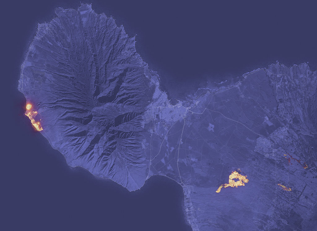
NASA aerial of the Lahaina fire on Maui.
This summer has been suffused with visceral reminders of the consequences of climate change: intense and extended heat waves, poor air quality, high ocean temperatures, and the list goes on. As geographers, we knew climate change was already here, but even so the last few months have caused grief and shock.
The fires in West Maui continue to be particularly upsetting. As I write this column nearly a month after the fire, emergency organizations have confirmed the death of 115 people and have posted the names of another 385 who are believed to be missing. It is one of deadliest wildfires in U.S. history. And history clearly matters here. The Maui fires were enabled by economic and ecological imperialism, as Kanaka scholar Kamana Beamer explained in a recent piece in The Guardian.
Until the nineteenth century, a dense Hawaiian population thrived in an abundant Lahaina landscape that featured flowing streams, waterways that irrigated taro and other crops, and a fishpond. But this sustainable food system was appropriated, manipulated, and in some cases destroyed to enable extractive plantation monocropping that lasted over a century. When the former sugar plantation shuttered its business in 1999, increased diversion of surface waters and the absence of active agricultural cultivation resulted in overgrowth of invasive non-native grasses, shrubs and trees that fueled the fire. As geographers have been arguing for more than half a century, there is no such thing as natural disaster.
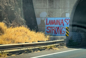
Local resident’s tribute, Lahaina Strong. Credit: State Farm Insurance
While there has been an outpouring of public support, other responses to the fires have been profoundly disheartening. Indigenous and environmental groups are contending with opportunists exploiting the tragedy to grab water and land rights. Residents of West Maui have instead advanced post-recovery visions for reducing inequality and increasing the strength and interconnection of human and non-human communities. That is a future worth fighting for (see the Maui United Way’s response to the fires; the Na’Aikane o Maui Cultural Center, a key player in the fight for Kanaka land rights; and ongoing efforts by the Hawai’i Alliance for Progressive Action).
All this means that climate change and AAG’s role in mitigating or exacerbating it are heavy on my mind.
AAG’s Work on Climate Thus Far
Thanks to the big-picture thinking of the Climate Action Task Force and the efforts of staff, AAG has made some important initial steps in mitigating its climate impacts. The entire AAG endowment has been de-carbonized, so that we no longer financially support the fossil-fuel industry. AAG has moved into a LEED Gold building, notably reducing its day-to-day emissions. The first cohort of the Elevate the Discipline program, intended to increase geography’s impact on public policy, is focused on climate change. Through these and other programs, Gary Langham and the AAG staff have made it clear that they are serious about climate change.
AAG’s remaining climate impacts come primarily from the annual meetings. That means that AAG as an organization and we as a discipline will need to make some hard choices if we are to have any hope of bringing our net emissions down to 0 by 2050 as spelled out in our climate action commitment.
Mitigating the Climate Impacts of Annual Meetings
There are multiple options that we could pursue to mitigate the impacts of our annual meetings.
While many other professional societies have backed away from hybrid conference models because they are expensive and logistically challenging, AAG is continuing to make it possible to attend the annual meeting virtually. Thus, one approach would be to eliminate or reduce travel emissions via virtual attendance and the node model pioneered this spring. Nodes would have the added benefit of allowing us to contract with smaller hotel chains and vendors with better approaches to mitigating their impacts.
Another option would be to change the pattern of our annual meetings more radically, holding large in-person conferences every other year. In the alternate years, AAG could organize a set of smaller “hubs” connected by video-conferencing, perhaps linked to the existing regional meetings; an entirely virtual meeting every other year would reduce emissions further. In either case, it would take creative thought to enable the intellectual community building that is such an important component of the annual meeting, but I believe it is doable.
A third option would be some sort of offset. As geographers and others environmental scientists have demonstrated repeatedly, offsets have a terrible track record. Leaders of the Energy and Environment Specialty Group recently suggested instead that AAG make a long-term investment in an alternative energy project that might actually offset some of our emissions, preferably one with a strong social justice component. If it were possible to find a legitimate project, this could be an important component of AAG’s climate mitigation strategy.
Over the long term, we need to pursue some combination of these more interventionist approaches (along with other creative ideas from the Climate Action Task Force and AAG members), if we are to have any hope of moving AAG to net zero. The bottom line here is that AAG is going to have to change, and to change radically. That means we as geographers will have to, too.
Immediate steps AAG members can take to mitigate the annual meeting’s climate impacts
There are things AAG members can do immediately to reduce the climate impact of the annual meeting: attend virtually and/or help to organize a node.
Attending virtually is one straightforward way to reduce emissions associated with the 2024 annual meeting. We need to work on making virtual attendance more engaging, though. AAG’s data shows that in the past few years, the average virtual participant attended fewer than two full sessions: their own and part of another. Thus, I would encourage anyone going the virtual route to think carefully about viable ways to increase their engagement with the annual meeting. I would also encourage specialty groups to develop at least one virtual networking event for their members.
Another thing members can do to reduce the carbon footprint of the 2024 annual meeting would be to help organize a node. This approach was pioneered last year with a mini-conference that brought together geographers in Montreal, and a watch party for students at Cal State Fullerton. Both were very successful, but organizing them took a substantial amount of work. If more people volunteered to help organize it would make a big difference. If you are interested in co-organizing a node, please contact Patricia Martin or Betsy Olson, the current co-chairs of the Climate Action Task Force.
Our work to reduce AAG 2024’s impact on carbon and climate change is intertwined with the important work so many are putting into centering Indigenous Hawaiian history, knowledge, struggles, and victories at the meeting in Honolulu. I hope, too, that all virtual attendees and nodes will prioritize attending the talks, panels, and featured sessions that focus on Kānaka Maoli. As geographers, we know that climate change is inextricably social and biophysical: prioritizing one at the cost of another cannot move us forwards.
I am very grateful for Neil Hannahs and Aurora Kagawa-Viviani’s review of and suggestions for this column.
Please note: The ideas expressed in the AAG President’s column are not necessarily the views of the AAG as a whole. This column is traditionally a space in which the president may talk about their views or focus during their tenure as president of AAG, or spotlight their areas of professional work. Please feel free to email the president directly at rlave [at] indiana [at] edu to enable a constructive discussion.
Share
Stories
On the Map: Where Were You When?
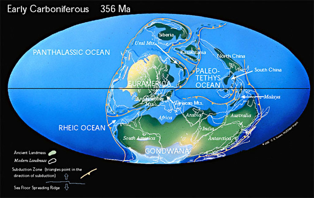
Earth in the Early Carboniferous period. Source: Christopher Scotese
By Allison Rivera
It is no secret that the Earth has drastically changed throughout history, though it can be hard to capture evidence of its evolution. Thanks to the innovative work of software engineer Ian Webster, you can explore Earth’s transformations in real time. Webster created an interactive “Ancient Earth” experience using the revolutionary work of palaeogeographer Christopher Scotese.
I always wanted to build a time machine. These maps allow me to travel back through time.
—Christopher Scotese
Scotese’s love and inspirations for paleogeography began during his childhood, when he would dream of traveling back in time. He recalls his ambitions from a young age: “I have had an interest in Earth History since childhood. During my summer vacations (age 8-10), I started a journal entitled A Review of Earth History by Eras and Periods. I always wanted to build a time machine. These maps allow me to ‘travel back through time.’”
It was from these ideas that his Atlas project was born. The Paleogeographic Atlas project began during his undergraduate career at the University of Illinois (Chicago). It was first published as what could be described as “flip books,” with some computer animations. It was not until his graduate career when the Atlas was updated to include principal scientific areas such as plate tectonics, paleomagnetism, and paleogeography. Despite other paleogeographic maps having been published at the time, these maps were noteworthy. The Atlas Project was the first to illustrate plate tectonics and paleogeographic evolution of the Earth. Scotese was also the first person to write software to animate the history of plate motions. However, he did face some challenges along the way. He noted that the greatest obstacle of the project was that “It takes a long time to accumulate the knowledge and experience to tell this story.” He is now writing a book titled The History of the Earth System, allowing him to compile the mass of information he has accrued over the years. Scotese also knew that updating the maps was no easy feat, and, with the help of many colleagues, has continued to integrate new and improved scientific ideas into the Atlas.
Scotese made sure to take many ideas into account from various scientists. Having worked with paleoclimatologist Judy Parish to incorporate paleoclimatic interpretations in the reconstructions of the Earth, he was able to develop a parametric climate model. Furthermore, Scotese used linear magnetic anomaly data and satellite imagery to create a model for Mesozoic and Cenozoic plate and ocean basin reconstruction. While his work paved the way for the current knowledge and understanding of time periods such as the Mesozoic and Cenozoic, those such as the Paleozoic remain unknown. Here, the map is based on information and results presented in a symposium on Paleozoic Paleogeography. The oldest map of the Atlas was the last to be assembled, but is based on a model Proterozoic plate tectonics, developed by Scotese and other geographers. From this, they were able to conclude that the Proterozoic was a time of Rodinia supercontinent assembly and breakup. Each map incorporates some form of scientific data and knowledge, making it as accurate as possible.
Despite the amount of collaboration, research, and time that went into this groundbreaking project, Scotese describes it as ongoing. The Atlas only describes the current knowledge and understanding of ancient Earth. As with any science project, new data and findings are always emerging, which leads to the need for constant updates and improvements to the Atlas. To keep up with new information, Scotese has a vision for a digital Atlas. Combining scientific data with technology such as GIS will allow for not only improved user friendliness but also easier compilation of data. Programs such as Paleo-GIS will be the foundation for the next version of the Atlas. In addition, Scotese is working with a group of scientists to add other Earth System information such paleoclimate, paleoenvironmental, biogeographic, and palaeoceanographic information.
Even though Webster’s project is based on the old version of the Atlas, it still has many features that make it easy to understand and educational. His work gives people living in today’s world a sense of connectedness to the ancient earth through time.
Wakefield Dort, Jr. was born on July 16, 1923, in Keene, NH, the son of Wakefield Dort, Sr. and Elizabeth (Edwards) Dort. He died peacefully in his home on Saturday, May 13, 2023 in Lawrence, KS.
He is survived by his son, Christopher Dort, his wife Missie, and two granddaughters, Brianne Dort and Erin Havrilak, her husband, Cody.
He was preceded in death by his wife, Doris Virginia Stage Dort.
Wake obtained his bachelor’s degree in geology from Harvard in 1944, went on to California Institute of Technology for a masters in 1948, and doctorate from Stanford 1955. Between his bachelors and masters, he served in the U.S. Marines as a second lieutenant in the Engineer Battalion of the First Marine Division and saw action on Peleliu (Palau Islands) in the South Pacific. His first teaching experience was as an Instructor in Mathematics in the Marine Corps schools in North Carolina.
After discharge from the Marines, he taught at Duke (1948-50) and Pennsylvania State (1952-57) universities prior to joining the faculty at University of Kansas (KU) as an associate professor and was promoted to professor in 1970. In addition to his teaching, he supervised nine doctoral students (including two in geography and two in special studies) and 24 masters in his time on the faculty.
Arriving at KU in the fall of 1957 as an associate professor, Dort took up teaching his specialty courses of geomorphology and Quaternary geology. In addition, for three and half decades he also taught a variety of courses including Physical Geology, History of the Earth, Geology for Engineers, and Environmental Geology. He was the geomorphologist at The University of Kansas and many, if not all, the geology majors were introduced to his subjects in their time at KU.
He worked in Idaho for a quarter of a century studying alpine glaciers in the Lemhi Mountains, northwest of Idaho Falls. He also was drawn to the Antarctica where he could study the modern glaciers. After retirement he researched the geomorphology of the Great Plains and the river systems, especially in the Kansas River. He has published extensively on Pleistocene geology and geomorphology of Kansas, described some of the archeological sites in the state, and published on the Pleistocene and recent environments of the central Great Plains with the effects of climate change. He has conducted field trips for various groups in Kansas and Nebraska. In addition to his studies in Idaho, Kansas, and Nebraska, another interest has been in the geomorphology of Antarctica.
Wake was active in several organizations and is a Fellow of the AAAS and the Geological Society of America and a member of the American Geographical Society, Association of American Geographers, Society of American Archeologists, and Sigma Xi. He was a member of the Executive Committee & Education for the Institute of Tertiary-Quaternary Studied, honorary lecturer for the Mid-American University Association, Research Associate at Idaho Museum of Natural History, member of the American Geological Institute’s Visual Education Committee and Earth science Curriculum Project, and a member of the U.S. Antarctic Expeditions in 1965, 1966, and 1969.
Wake retired with emeritus status in 1993, from teaching but continued his research. One of the results being an in-depth study of the changes in the course of the Kansas River through time. The results of his investigation were published as an American Geographical Society Special Publication in 2009.
The family would like to thank Ascend Hospice and Home Instead for their care and compassion. Without these loving professionals, Wakes wish to remain in his home until death could not have happened. A special thank you for Justine who cared for Wake for over 6 years and became a trusted friend and extended family member.
Two new interns have joined the AAG staff this semester! The AAG would like to welcome Iman and Allison to the organization.
Iman Smith is a junior at the University of Maryland, pursuing a B.S. in Geographical Sciences and a minor in Geographic Information Systems. Her areas of interest include agricultural monitoring and crop management, and global food security. In her spare time, Iman likes to travel, crochet, make pottery, and she also hosts a college radio show.
Allison Rivera is a senior at the University of Connecticut pursuing a B.S. in Geoscience and a minor in Geography. She is mostly interested in geomorphology and physical geography and is currently completing a senior thesis on such topics. After graduation, Allison hopes to attend graduate school and pursue further research in the field of geomorphology. In her spare time, she enjoys watching cartoons, going for walks, and reading.
If you or someone you know is interested in applying for an internship at the AAG, the AAG seeks interns on a year-round basis for the spring, summer, and fall semesters.
Laurence Allan James passed from this world in the loving arms of his sister and niece on the night of December 3, 2022.
Allan (AKA, A.J.) was born in Hollywood, California, on March 18, 1949, into a family of many geologists. His family moved to Sacramento in northern California in 1956. He was active in Little League baseball and later attended Mira Loma High School, where he was on the Honor Roll, elected Senior Class President, played basketball and ran on the cross-country track team. He also began to write songs and play guitar with his friends. The garage band at 4425 Glen Oak Court was infamous.
After high school, he interrupted his studies at University of California, Berkeley a number of times to pursue his singer-songwriter aspirations. Allan helped run a café on Bleeker Street in New York City and busked in Europe. He hitchhiked across the United States to greet his newborn niece.
He earned his bachelor’s degree in 1978 and moved to Madison, Wisconsin, where he pursued two Masters of Science degrees, in Water Resources Management and in Geography, with Jim Knox as his advisor. His Ph.D., also from the University of Wisconsin, was held jointly in Geography and Geology, with James C. Knox and David M. Mickelson as his dissertation advisors. While in Madison, he researched several family pioneers, including a Civil War hero who has a statue there.
Allan taught at the University of Wisconsin and in Atlanta, Georgia before moving to the University of South Carolina in 1988, where he was a professor in the Geography Department for three decades. He also served as Director of the BioGeomorphology Laboratory and Senior Associate in the Environment and Sustainability Program.
His teaching and research primarily focused on fluvial geomorphology with emphases on river sedimentation, floodplain and channel morphogenesis following human activities, interactions between alluvium and flooding, and the use of spatial analysis in geomorphology. Specific themes included investigations of hydraulic mining sediment in California, historical erosion by rills and gullies and floodplain sedimentation in the U.S. southeastern Piedmont, concepts of legacy (anthropogenic) sediment, Quaternary glaciations of the northwestern Sierra Nevada in California, geomorphometry and geomorphic change detection.
He was a member of national and international societies encompassing the field of geomorphology, including the Geological Society of America (GSA) and the American Association of Geographers (AAG) and received a number of Distinguished Career awards. The Southeastern Division and Water Resources Specialty Group of AAG honored him with Distinguished Career awards in 2018. The Geomorphology Specialty Group (GSG) of the AAG presented him with the Grove Karl Gilbert Award for Excellence in Research in 2015 and the Melvin G. Marcus Distinguished Career Award in 2023. (He was notified of the latter award by his friends prior to his death.)
Allan was predeceased by his parents, Laurence B. and Elizabeth M. James, and his brother Benjamin. He is survived by his sister Catherine (JJ) DeMauro, his brother Stephen, his niece Stacey Swatek Huie and her spouse Jeremy, their daughters Madeleine and Miriya, his ex-wife Myrna N. Skoda James, her sons Joseph Skoda, Jr. and Jesse Skoda, granddaughters Chloe and Kylie, and his beloved companion Dr. Marcia Ehinger.
According to his wishes, he will be cremated and interred in his parents’ plot at East Lawn Cemetery on Greenback Lane in Sacramento, California. Celebration of life events are planned at his sister’s home and at the AAG annual meeting in 2023.
AAG Members get exclusive access to publications, prominent journals, unique advocacy, grant, scholarship and professional opportunities with access to industry focus communities, and event discounts, including our annual meeting.
Some content may only be accessible if you belong to specific Specialty or Affinity Groups. You can still update your membership below. You will need to go through the Join flow, but you do not need to repurchase your membership unless it is expired or about to expire.
To provide the best experiences, we use technologies like cookies to store and/or access device information. Consenting to these technologies will allow us to process data such as browsing behavior or unique IDs on this site. Not consenting or withdrawing consent, may adversely affect certain features and functions.
Functional
Always active
The technical storage or access is strictly necessary for the legitimate purpose of enabling the use of a specific service explicitly requested by the subscriber or user, or for the sole purpose of carrying out the transmission of a communication over an electronic communications network.
Preferences
The technical storage or access is necessary for the legitimate purpose of storing preferences that are not requested by the subscriber or user.
Statistics
The technical storage or access that is used exclusively for statistical purposes.The technical storage or access that is used exclusively for anonymous statistical purposes. Without a subpoena, voluntary compliance on the part of your Internet Service Provider, or additional records from a third party, information stored or retrieved for this purpose alone cannot usually be used to identify you.
Marketing
The technical storage or access is required to create user profiles to send advertising, or to track the user on a website or across several websites for similar marketing purposes.

 Iman Smith is a junior at the University of Maryland, pursuing a B.S. in Geographical Sciences and a minor in Geographic Information Systems. Her areas of interest include agricultural monitoring and crop management, and global food security. In her spare time, Iman likes to travel, crochet, make pottery, and she also hosts a college radio show.
 Allison Rivera is a senior at the University of Connecticut pursuing a B.S. in Geoscience and a minor in Geography. She is mostly interested in geomorphology and physical geography and is currently completing a senior thesis on such topics. After graduation, Allison hopes to attend graduate school and pursue further research in the field of geomorphology. In her spare time, she enjoys watching cartoons, going for walks, and reading.