Lauren Sinclair – Middle School Teacher, Oregon
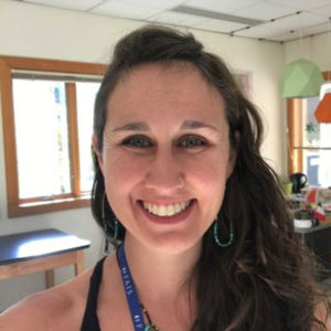
Photo of Lauren SinclairPosition: Middle School GIS Teacher! It’s my dream job!

What was your favorite class in K-12? I loved it all. I think that’s why I’m a teacher. But in undergrad my favorite classes were all geography… so I asked my favorite geography professor for advice on learning more. Because of his awesome advice I tried my first GIS and ended up at PSU studying geomorphology and GIS for my master’s.

How did you first learn about and/or use GIS? My first GIS experience is freeze-framed in my memory, which is exactly why I love recreating that magical experience for my students every semester. It was an exploration of the Ring of Fire on an early version of ArcMap in 2005 or so… what I remember most was following the directions and turning on the volcanoes layer, the earthquakes layer, and then the plate boundaries layer… and I felt like I had discovered plate tectonics myself! My immediate thought was “kids have got to try this!”

Name one thing you love about GIS and/or geography: GIS has evolved to be more intuitive and user friendly every year. It’s already at a point where my 6th-8th graders learn how to use ArcGISOnline independently over the course of about 30 hours in one semester… and some of my 8th graders are honestly better at spatial analysis than I am by the end of the semester. That’s powerful. That tells me that we need to give youth more opportunities to use this technology earlier… we shouldn’t wait until an undergraduate program to introduce people to GIS!

Why did you want to volunteer as a GeoMentor? I guess I see myself as a GeoMentor advocate. When I started turning the technology class at my middle school into a GIS class, I had no idea what to do, so I reached out to the GeoMentor network and connected to some of my PSU professors. They got me from crawling to running in no time! I’ve since invited dozens of GIS professionals to my classroom and encouraged them to become GeoMentors. It’s important for my students to meet GIS professionals in person and see the huge range of applications for the technology. They’ve met people from Esri, MapBox, Quantum Spatial, Extensis, Portland State University, Portland Community College, and more! There are so many more classrooms out there that will never experience GIS without the encouragement and support of a GeoMentor, which is why I’m always encouraging GIS professionals to visit a classroom!

If someone asked you why they should learn about GIS and/or geography, how would you respond in one sentence? The kids in school right now are the meme generation; they communicate visually. That means they’re primed to communicate with GIS! I want the world to catch on to this perfect match and put GIS in as many classrooms as possible.

WebsiteFAIS ArcGIS Online homepage

Twitter@MrsSinclairMaps

    Share

Jessica Perkins – GIS and Technical Support Program Manager, West Virginia

Photo of Lauren SinclairPosition: Middle School GIS Teacher! It’s my dream job!

What was your favorite class in K-12? I loved it all. I think that’s why I’m a teacher. But in undergrad my favorite classes were all geography… so I asked my favorite geography professor for advice on learning more. Because of his awesome advice I tried my first GIS and ended up at PSU studying geomorphology and GIS for my master’s.

How did you first learn about and/or use GIS? My first GIS experience is freeze-framed in my memory, which is exactly why I love recreating that magical experience for my students every semester. It was an exploration of the Ring of Fire on an early version of ArcMap in 2005 or so… what I remember most was following the directions and turning on the volcanoes layer, the earthquakes layer, and then the plate boundaries layer… and I felt like I had discovered plate tectonics myself! My immediate thought was “kids have got to try this!”

Name one thing you love about GIS and/or geography: GIS has evolved to be more intuitive and user friendly every year. It’s already at a point where my 6th-8th graders learn how to use ArcGISOnline independently over the course of about 30 hours in one semester… and some of my 8th graders are honestly better at spatial analysis than I am by the end of the semester. That’s powerful. That tells me that we need to give youth more opportunities to use this technology earlier… we shouldn’t wait until an undergraduate program to introduce people to GIS!

Why did you want to volunteer as a GeoMentor? I guess I see myself as a GeoMentor advocate. When I started turning the technology class at my middle school into a GIS class, I had no idea what to do, so I reached out to the GeoMentor network and connected to some of my PSU professors. They got me from crawling to running in no time! I’ve since invited dozens of GIS professionals to my classroom and encouraged them to become GeoMentors. It’s important for my students to meet GIS professionals in person and see the huge range of applications for the technology. They’ve met people from Esri, MapBox, Quantum Spatial, Extensis, Portland State University, Portland Community College, and more! There are so many more classrooms out there that will never experience GIS without the encouragement and support of a GeoMentor, which is why I’m always encouraging GIS professionals to visit a classroom!

If someone asked you why they should learn about GIS and/or geography, how would you respond in one sentence? The kids in school right now are the meme generation; they communicate visually. That means they’re primed to communicate with GIS! I want the world to catch on to this perfect match and put GIS in as many classrooms as possible.

WebsiteFAIS ArcGIS Online homepage

Twitter@MrsSinclairMaps

    Share

Michael Camponovo – GIS Outreach Coordinator, Tennessee

Photo of Lauren SinclairPosition: Middle School GIS Teacher! It’s my dream job!

What was your favorite class in K-12? I loved it all. I think that’s why I’m a teacher. But in undergrad my favorite classes were all geography… so I asked my favorite geography professor for advice on learning more. Because of his awesome advice I tried my first GIS and ended up at PSU studying geomorphology and GIS for my master’s.

How did you first learn about and/or use GIS? My first GIS experience is freeze-framed in my memory, which is exactly why I love recreating that magical experience for my students every semester. It was an exploration of the Ring of Fire on an early version of ArcMap in 2005 or so… what I remember most was following the directions and turning on the volcanoes layer, the earthquakes layer, and then the plate boundaries layer… and I felt like I had discovered plate tectonics myself! My immediate thought was “kids have got to try this!”

Name one thing you love about GIS and/or geography: GIS has evolved to be more intuitive and user friendly every year. It’s already at a point where my 6th-8th graders learn how to use ArcGISOnline independently over the course of about 30 hours in one semester… and some of my 8th graders are honestly better at spatial analysis than I am by the end of the semester. That’s powerful. That tells me that we need to give youth more opportunities to use this technology earlier… we shouldn’t wait until an undergraduate program to introduce people to GIS!

Why did you want to volunteer as a GeoMentor? I guess I see myself as a GeoMentor advocate. When I started turning the technology class at my middle school into a GIS class, I had no idea what to do, so I reached out to the GeoMentor network and connected to some of my PSU professors. They got me from crawling to running in no time! I’ve since invited dozens of GIS professionals to my classroom and encouraged them to become GeoMentors. It’s important for my students to meet GIS professionals in person and see the huge range of applications for the technology. They’ve met people from Esri, MapBox, Quantum Spatial, Extensis, Portland State University, Portland Community College, and more! There are so many more classrooms out there that will never experience GIS without the encouragement and support of a GeoMentor, which is why I’m always encouraging GIS professionals to visit a classroom!

If someone asked you why they should learn about GIS and/or geography, how would you respond in one sentence? The kids in school right now are the meme generation; they communicate visually. That means they’re primed to communicate with GIS! I want the world to catch on to this perfect match and put GIS in as many classrooms as possible.

WebsiteFAIS ArcGIS Online homepage

Twitter@MrsSinclairMaps

    Share

Madhuri Adapala – GIS Analyst, Louisiana

Photo of Lauren SinclairPosition: Middle School GIS Teacher! It’s my dream job!

What was your favorite class in K-12? I loved it all. I think that’s why I’m a teacher. But in undergrad my favorite classes were all geography… so I asked my favorite geography professor for advice on learning more. Because of his awesome advice I tried my first GIS and ended up at PSU studying geomorphology and GIS for my master’s.

How did you first learn about and/or use GIS? My first GIS experience is freeze-framed in my memory, which is exactly why I love recreating that magical experience for my students every semester. It was an exploration of the Ring of Fire on an early version of ArcMap in 2005 or so… what I remember most was following the directions and turning on the volcanoes layer, the earthquakes layer, and then the plate boundaries layer… and I felt like I had discovered plate tectonics myself! My immediate thought was “kids have got to try this!”

Name one thing you love about GIS and/or geography: GIS has evolved to be more intuitive and user friendly every year. It’s already at a point where my 6th-8th graders learn how to use ArcGISOnline independently over the course of about 30 hours in one semester… and some of my 8th graders are honestly better at spatial analysis than I am by the end of the semester. That’s powerful. That tells me that we need to give youth more opportunities to use this technology earlier… we shouldn’t wait until an undergraduate program to introduce people to GIS!

Why did you want to volunteer as a GeoMentor? I guess I see myself as a GeoMentor advocate. When I started turning the technology class at my middle school into a GIS class, I had no idea what to do, so I reached out to the GeoMentor network and connected to some of my PSU professors. They got me from crawling to running in no time! I’ve since invited dozens of GIS professionals to my classroom and encouraged them to become GeoMentors. It’s important for my students to meet GIS professionals in person and see the huge range of applications for the technology. They’ve met people from Esri, MapBox, Quantum Spatial, Extensis, Portland State University, Portland Community College, and more! There are so many more classrooms out there that will never experience GIS without the encouragement and support of a GeoMentor, which is why I’m always encouraging GIS professionals to visit a classroom!

If someone asked you why they should learn about GIS and/or geography, how would you respond in one sentence? The kids in school right now are the meme generation; they communicate visually. That means they’re primed to communicate with GIS! I want the world to catch on to this perfect match and put GIS in as many classrooms as possible.

WebsiteFAIS ArcGIS Online homepage

Twitter@MrsSinclairMaps

    Share

Rob Kraft – Program Manager, California

Photo of Lauren SinclairPosition: Middle School GIS Teacher! It’s my dream job!

What was your favorite class in K-12? I loved it all. I think that’s why I’m a teacher. But in undergrad my favorite classes were all geography… so I asked my favorite geography professor for advice on learning more. Because of his awesome advice I tried my first GIS and ended up at PSU studying geomorphology and GIS for my master’s.

How did you first learn about and/or use GIS? My first GIS experience is freeze-framed in my memory, which is exactly why I love recreating that magical experience for my students every semester. It was an exploration of the Ring of Fire on an early version of ArcMap in 2005 or so… what I remember most was following the directions and turning on the volcanoes layer, the earthquakes layer, and then the plate boundaries layer… and I felt like I had discovered plate tectonics myself! My immediate thought was “kids have got to try this!”

Name one thing you love about GIS and/or geography: GIS has evolved to be more intuitive and user friendly every year. It’s already at a point where my 6th-8th graders learn how to use ArcGISOnline independently over the course of about 30 hours in one semester… and some of my 8th graders are honestly better at spatial analysis than I am by the end of the semester. That’s powerful. That tells me that we need to give youth more opportunities to use this technology earlier… we shouldn’t wait until an undergraduate program to introduce people to GIS!

Why did you want to volunteer as a GeoMentor? I guess I see myself as a GeoMentor advocate. When I started turning the technology class at my middle school into a GIS class, I had no idea what to do, so I reached out to the GeoMentor network and connected to some of my PSU professors. They got me from crawling to running in no time! I’ve since invited dozens of GIS professionals to my classroom and encouraged them to become GeoMentors. It’s important for my students to meet GIS professionals in person and see the huge range of applications for the technology. They’ve met people from Esri, MapBox, Quantum Spatial, Extensis, Portland State University, Portland Community College, and more! There are so many more classrooms out there that will never experience GIS without the encouragement and support of a GeoMentor, which is why I’m always encouraging GIS professionals to visit a classroom!

If someone asked you why they should learn about GIS and/or geography, how would you respond in one sentence? The kids in school right now are the meme generation; they communicate visually. That means they’re primed to communicate with GIS! I want the world to catch on to this perfect match and put GIS in as many classrooms as possible.

WebsiteFAIS ArcGIS Online homepage

Twitter@MrsSinclairMaps

    Share

Frank Romo – Public Safety Data Manager & Geospatial Consultant, Michigan

Photo of Lauren SinclairPosition: Middle School GIS Teacher! It’s my dream job!

What was your favorite class in K-12? I loved it all. I think that’s why I’m a teacher. But in undergrad my favorite classes were all geography… so I asked my favorite geography professor for advice on learning more. Because of his awesome advice I tried my first GIS and ended up at PSU studying geomorphology and GIS for my master’s.

How did you first learn about and/or use GIS? My first GIS experience is freeze-framed in my memory, which is exactly why I love recreating that magical experience for my students every semester. It was an exploration of the Ring of Fire on an early version of ArcMap in 2005 or so… what I remember most was following the directions and turning on the volcanoes layer, the earthquakes layer, and then the plate boundaries layer… and I felt like I had discovered plate tectonics myself! My immediate thought was “kids have got to try this!”

Name one thing you love about GIS and/or geography: GIS has evolved to be more intuitive and user friendly every year. It’s already at a point where my 6th-8th graders learn how to use ArcGISOnline independently over the course of about 30 hours in one semester… and some of my 8th graders are honestly better at spatial analysis than I am by the end of the semester. That’s powerful. That tells me that we need to give youth more opportunities to use this technology earlier… we shouldn’t wait until an undergraduate program to introduce people to GIS!

Why did you want to volunteer as a GeoMentor? I guess I see myself as a GeoMentor advocate. When I started turning the technology class at my middle school into a GIS class, I had no idea what to do, so I reached out to the GeoMentor network and connected to some of my PSU professors. They got me from crawling to running in no time! I’ve since invited dozens of GIS professionals to my classroom and encouraged them to become GeoMentors. It’s important for my students to meet GIS professionals in person and see the huge range of applications for the technology. They’ve met people from Esri, MapBox, Quantum Spatial, Extensis, Portland State University, Portland Community College, and more! There are so many more classrooms out there that will never experience GIS without the encouragement and support of a GeoMentor, which is why I’m always encouraging GIS professionals to visit a classroom!

If someone asked you why they should learn about GIS and/or geography, how would you respond in one sentence? The kids in school right now are the meme generation; they communicate visually. That means they’re primed to communicate with GIS! I want the world to catch on to this perfect match and put GIS in as many classrooms as possible.

WebsiteFAIS ArcGIS Online homepage

Twitter@MrsSinclairMaps

    Share

Parveen Chhetri – Assistant Professor, California

Photo of Lauren SinclairPosition: Middle School GIS Teacher! It’s my dream job!

What was your favorite class in K-12? I loved it all. I think that’s why I’m a teacher. But in undergrad my favorite classes were all geography… so I asked my favorite geography professor for advice on learning more. Because of his awesome advice I tried my first GIS and ended up at PSU studying geomorphology and GIS for my master’s.

How did you first learn about and/or use GIS? My first GIS experience is freeze-framed in my memory, which is exactly why I love recreating that magical experience for my students every semester. It was an exploration of the Ring of Fire on an early version of ArcMap in 2005 or so… what I remember most was following the directions and turning on the volcanoes layer, the earthquakes layer, and then the plate boundaries layer… and I felt like I had discovered plate tectonics myself! My immediate thought was “kids have got to try this!”

Name one thing you love about GIS and/or geography: GIS has evolved to be more intuitive and user friendly every year. It’s already at a point where my 6th-8th graders learn how to use ArcGISOnline independently over the course of about 30 hours in one semester… and some of my 8th graders are honestly better at spatial analysis than I am by the end of the semester. That’s powerful. That tells me that we need to give youth more opportunities to use this technology earlier… we shouldn’t wait until an undergraduate program to introduce people to GIS!

Why did you want to volunteer as a GeoMentor? I guess I see myself as a GeoMentor advocate. When I started turning the technology class at my middle school into a GIS class, I had no idea what to do, so I reached out to the GeoMentor network and connected to some of my PSU professors. They got me from crawling to running in no time! I’ve since invited dozens of GIS professionals to my classroom and encouraged them to become GeoMentors. It’s important for my students to meet GIS professionals in person and see the huge range of applications for the technology. They’ve met people from Esri, MapBox, Quantum Spatial, Extensis, Portland State University, Portland Community College, and more! There are so many more classrooms out there that will never experience GIS without the encouragement and support of a GeoMentor, which is why I’m always encouraging GIS professionals to visit a classroom!

If someone asked you why they should learn about GIS and/or geography, how would you respond in one sentence? The kids in school right now are the meme generation; they communicate visually. That means they’re primed to communicate with GIS! I want the world to catch on to this perfect match and put GIS in as many classrooms as possible.

WebsiteFAIS ArcGIS Online homepage

Twitter@MrsSinclairMaps

    Share

Erin Silva – Project Manager, Maryland

Photo of Lauren SinclairPosition: Middle School GIS Teacher! It’s my dream job!

What was your favorite class in K-12? I loved it all. I think that’s why I’m a teacher. But in undergrad my favorite classes were all geography… so I asked my favorite geography professor for advice on learning more. Because of his awesome advice I tried my first GIS and ended up at PSU studying geomorphology and GIS for my master’s.

How did you first learn about and/or use GIS? My first GIS experience is freeze-framed in my memory, which is exactly why I love recreating that magical experience for my students every semester. It was an exploration of the Ring of Fire on an early version of ArcMap in 2005 or so… what I remember most was following the directions and turning on the volcanoes layer, the earthquakes layer, and then the plate boundaries layer… and I felt like I had discovered plate tectonics myself! My immediate thought was “kids have got to try this!”

Name one thing you love about GIS and/or geography: GIS has evolved to be more intuitive and user friendly every year. It’s already at a point where my 6th-8th graders learn how to use ArcGISOnline independently over the course of about 30 hours in one semester… and some of my 8th graders are honestly better at spatial analysis than I am by the end of the semester. That’s powerful. That tells me that we need to give youth more opportunities to use this technology earlier… we shouldn’t wait until an undergraduate program to introduce people to GIS!

Why did you want to volunteer as a GeoMentor? I guess I see myself as a GeoMentor advocate. When I started turning the technology class at my middle school into a GIS class, I had no idea what to do, so I reached out to the GeoMentor network and connected to some of my PSU professors. They got me from crawling to running in no time! I’ve since invited dozens of GIS professionals to my classroom and encouraged them to become GeoMentors. It’s important for my students to meet GIS professionals in person and see the huge range of applications for the technology. They’ve met people from Esri, MapBox, Quantum Spatial, Extensis, Portland State University, Portland Community College, and more! There are so many more classrooms out there that will never experience GIS without the encouragement and support of a GeoMentor, which is why I’m always encouraging GIS professionals to visit a classroom!

If someone asked you why they should learn about GIS and/or geography, how would you respond in one sentence? The kids in school right now are the meme generation; they communicate visually. That means they’re primed to communicate with GIS! I want the world to catch on to this perfect match and put GIS in as many classrooms as possible.

WebsiteFAIS ArcGIS Online homepage

Twitter@MrsSinclairMaps

    Share

Tanya Bigos – Health & Human Services, Massachusetts

Photo of Lauren SinclairPosition: Middle School GIS Teacher! It’s my dream job!

What was your favorite class in K-12? I loved it all. I think that’s why I’m a teacher. But in undergrad my favorite classes were all geography… so I asked my favorite geography professor for advice on learning more. Because of his awesome advice I tried my first GIS and ended up at PSU studying geomorphology and GIS for my master’s.

How did you first learn about and/or use GIS? My first GIS experience is freeze-framed in my memory, which is exactly why I love recreating that magical experience for my students every semester. It was an exploration of the Ring of Fire on an early version of ArcMap in 2005 or so… what I remember most was following the directions and turning on the volcanoes layer, the earthquakes layer, and then the plate boundaries layer… and I felt like I had discovered plate tectonics myself! My immediate thought was “kids have got to try this!”

Name one thing you love about GIS and/or geography: GIS has evolved to be more intuitive and user friendly every year. It’s already at a point where my 6th-8th graders learn how to use ArcGISOnline independently over the course of about 30 hours in one semester… and some of my 8th graders are honestly better at spatial analysis than I am by the end of the semester. That’s powerful. That tells me that we need to give youth more opportunities to use this technology earlier… we shouldn’t wait until an undergraduate program to introduce people to GIS!

Why did you want to volunteer as a GeoMentor? I guess I see myself as a GeoMentor advocate. When I started turning the technology class at my middle school into a GIS class, I had no idea what to do, so I reached out to the GeoMentor network and connected to some of my PSU professors. They got me from crawling to running in no time! I’ve since invited dozens of GIS professionals to my classroom and encouraged them to become GeoMentors. It’s important for my students to meet GIS professionals in person and see the huge range of applications for the technology. They’ve met people from Esri, MapBox, Quantum Spatial, Extensis, Portland State University, Portland Community College, and more! There are so many more classrooms out there that will never experience GIS without the encouragement and support of a GeoMentor, which is why I’m always encouraging GIS professionals to visit a classroom!

If someone asked you why they should learn about GIS and/or geography, how would you respond in one sentence? The kids in school right now are the meme generation; they communicate visually. That means they’re primed to communicate with GIS! I want the world to catch on to this perfect match and put GIS in as many classrooms as possible.

WebsiteFAIS ArcGIS Online homepage

Twitter@MrsSinclairMaps

    Share

Daniel Yelito – Transportation Services Manager, Pennsylvania

Photo of Lauren SinclairPosition: Middle School GIS Teacher! It’s my dream job!

What was your favorite class in K-12? I loved it all. I think that’s why I’m a teacher. But in undergrad my favorite classes were all geography… so I asked my favorite geography professor for advice on learning more. Because of his awesome advice I tried my first GIS and ended up at PSU studying geomorphology and GIS for my master’s.

How did you first learn about and/or use GIS? My first GIS experience is freeze-framed in my memory, which is exactly why I love recreating that magical experience for my students every semester. It was an exploration of the Ring of Fire on an early version of ArcMap in 2005 or so… what I remember most was following the directions and turning on the volcanoes layer, the earthquakes layer, and then the plate boundaries layer… and I felt like I had discovered plate tectonics myself! My immediate thought was “kids have got to try this!”

Name one thing you love about GIS and/or geography: GIS has evolved to be more intuitive and user friendly every year. It’s already at a point where my 6th-8th graders learn how to use ArcGISOnline independently over the course of about 30 hours in one semester… and some of my 8th graders are honestly better at spatial analysis than I am by the end of the semester. That’s powerful. That tells me that we need to give youth more opportunities to use this technology earlier… we shouldn’t wait until an undergraduate program to introduce people to GIS!

Why did you want to volunteer as a GeoMentor? I guess I see myself as a GeoMentor advocate. When I started turning the technology class at my middle school into a GIS class, I had no idea what to do, so I reached out to the GeoMentor network and connected to some of my PSU professors. They got me from crawling to running in no time! I’ve since invited dozens of GIS professionals to my classroom and encouraged them to become GeoMentors. It’s important for my students to meet GIS professionals in person and see the huge range of applications for the technology. They’ve met people from Esri, MapBox, Quantum Spatial, Extensis, Portland State University, Portland Community College, and more! There are so many more classrooms out there that will never experience GIS without the encouragement and support of a GeoMentor, which is why I’m always encouraging GIS professionals to visit a classroom!

If someone asked you why they should learn about GIS and/or geography, how would you respond in one sentence? The kids in school right now are the meme generation; they communicate visually. That means they’re primed to communicate with GIS! I want the world to catch on to this perfect match and put GIS in as many classrooms as possible.

WebsiteFAIS ArcGIS Online homepage

Twitter@MrsSinclairMaps

    Share